
3/11 | Severe Weather Over, Attention Turns to Weekend System
- Patrick Murray

- Mar 11
- 2 min read
Now that the active severe weather pattern is over across the Stateline region, our attention now turns to another storm system expected to impact the area over the weekend. While there is still considerable disagreement among models, we do think that at least some wintry impacts will be felt from this system.
This week will be rather seasonal, with highs in the low to mid 40s through the weekend, though cooler temps are in store for the beginning of next week once our weekend storm system moves through. We'll discuss that more here in a second. Showers are likely Thursday night, but other than that, we look to stay pretty dry for the remainder of this week.
For this weekend's storm, the two long range models we typically look at (the Euro and the GFS) are depicting two separate solutions at this point, and their respective ensembles have a wide variety of solutions, so it's difficult to describe exactly what's going to happen, but we have some general ideas.
First, the GFS has a more northerly low track, ejecting the trough just north of St. Louis, MO, up through central/northern Illinois and eventually just north of Chicago, IL into southern Michigan. This would favor a slightly warmer solution. A rain/snow mix is forecasted for Sunday currently. Once the trough passes through, strong northerly wind gusts will take over and usher in much cooler air, meaning any wrap-around precip. would likely fall as snow (potentially heavy, with near blizzard/blizzard conditions possible, thanks to gusty winds).

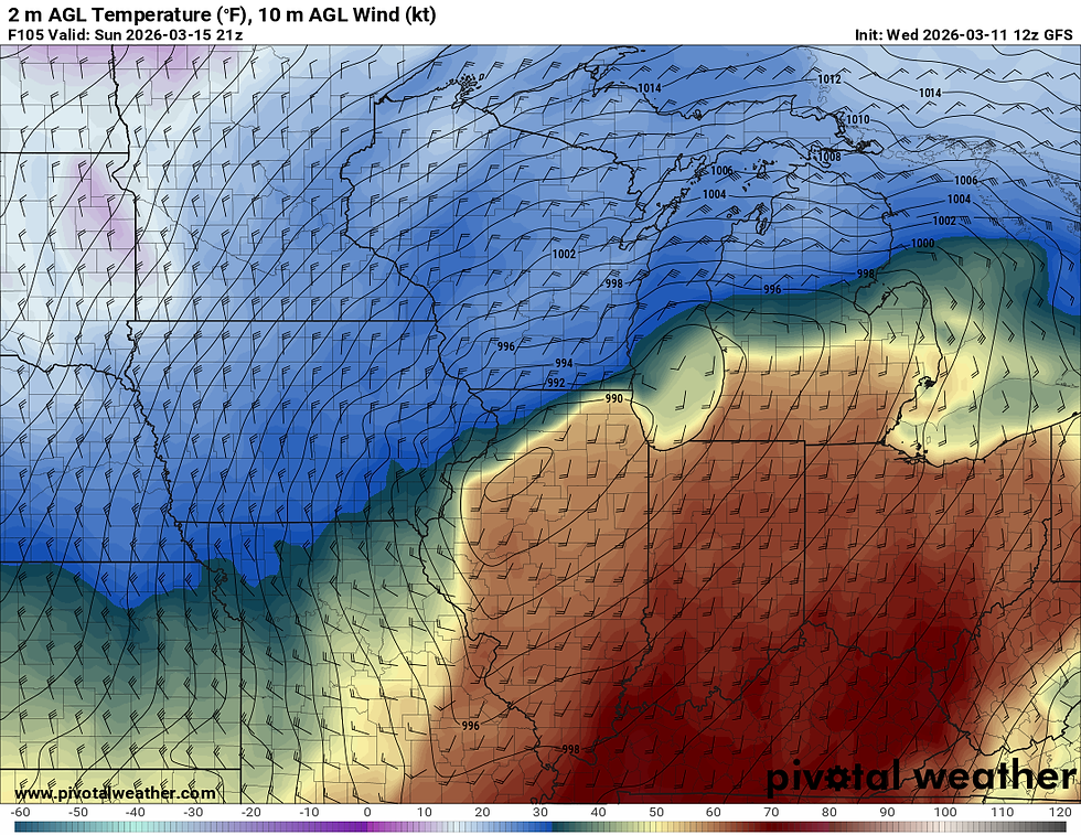
As you can see in the above images, a tight thermal gradient will exist wherever the warm front does set up. North of the warm front, cooler temps will result in mostly snow, with some areas seeing a rain/snow mix. Along and just south of the warm front, a rain snow mix/just rain will be possible, and south of the warm front, mostly rain and thunderstorms (some strong?) will be expected. I expect the area to start with a wintry mix and then slowly transition to all snow as cooler temperatures are brought in by northerly winds north of the warm front.
The ECMWF (Euro) has the center of pressure a tad farther south, depicting a cooler solution for the Stateline. Nevertheless, we will, again, likely start as rain, transition into a rain/snow mix and then eventually transition over to all snow as the trough ejects.

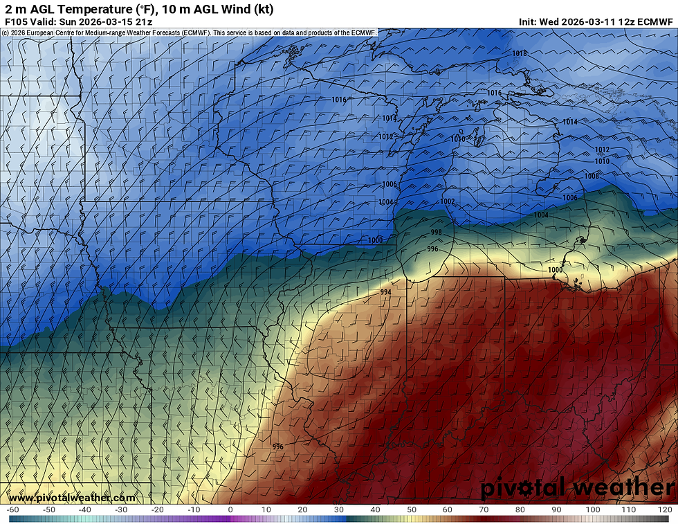
As seen above, the ECMWF depicts a further south track of the trough leading to a slightly less tight thermal gradient across the Stateline. A more southerly track would allow precip to fall as all snow longer. A northerly track will result in more rain/mix.
Regardless of track, both models depict very strong wind gusts behind the trough, as cold northerly air is funneled in. Once we transition to all snow, near blizzard conditions may be possible if the low is as strong as currently forecasted to be. Something to keep an eye on in the coming days for sure.

Comments