
3/13 | Strong Winds to Subside, Another Strong Storm System Incoming
- Patrick Murray

- Mar 13
- 2 min read
Area Forecast Discussion
Stateline Severe Weather
8:17 PM CDT Fri Mar 13 2026
...KEY MESSAGES...
Strong gusty winds will begin to weaken this afternoon
Waves of thunderstorms may occur on Sunday. There is a level 1 out of 5 risk for severe thunderstorms Sunday afternoon across the Stateline
Accumulating snow accompanied by strong northwesterly wind gusts over 40 mph expected Sunday night into Monday.
Bitter cold temps expected Monday and Tuesday, with overnight windchill values reaching 15 below zero in some places.
Warming trend expected in the second half of next week.
...DISCUSSION...
Through Saturday:
A strong pressure gradient exists across the Stateline associated with a deepening surface low across northern Lower Michigan. Maximum gusts in excess of 60 mph have been reported across the area. Wind headlines have expired/will expire shortly across the area as gusts begin to weaken into the evening.
Tonight into Saturday, a cold front will become draped right across our region in the wake of today's storm system. This will set the stage for the potential for some light snow Saturday across mainly northern portions of the area. Not expecting really any impacts from this as temps Saturday will be well into the 40s.
Saturday Night through Friday:
A deepening area of low pressure is expected to be digging into the central Plains overnight Saturday with a surface low developing. As the low develops, strong warm air advection is expected to materialize across the mid Mississippi River Valley. Latest forecasts continue to show some precipitation developing along the baroclinic zone as it moves across far northern Illinois into southern Wisconsin. Most of the area will remain dry, but we can't rule out a few rain/snow showers along this area.
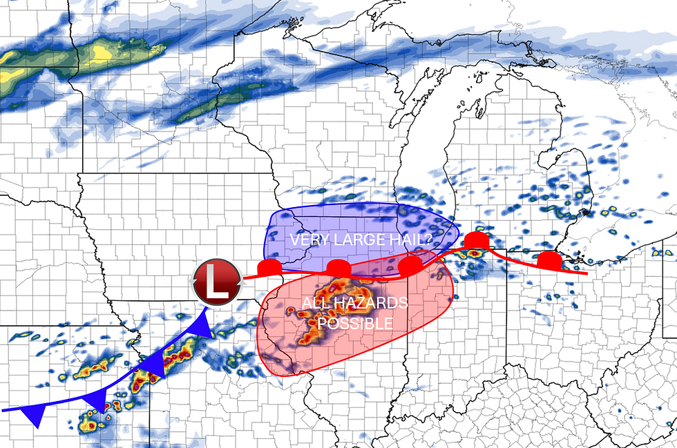
Ingredients continue to look conductive of showers and thunderstorms as the surface low propegates through the area on Sunday. Highs could reach the upper 50s in some areas per latest model guidance, though most of us will top out in the low to mid 50s. As the surface low approaches with a strong cold front, increasing shear and instability ahead of the baroclinic zone will support at least a conditional threat of severe thunderstorms across the area, with the threat increasing the farther south and east you go. Because of this, the SPC has placed the entire region in a level 1/5 MRGL risk for severe thunderstorms, mainly to accompany a damaging wind risk.
As the surface low passes overhead, southerly flow will become northwesterly flow ushering in very cold temperatures. Highs in the 20s are expected on Tuesday. Widespread rain/thunderstorms will quickly transition into snow (with some sleet potential briefly) overnight Sunday into Tuesday. We are watching models carefully, and may need to increase snow accumulation totals as models continue to be more and more bullish. NWS Quad Cities and NWS Milwaukee have issued WINTER STORM WATCHES for their counties, while NWS Chicago continues to monitor the trends, and may post headlines overnight tonight.
Warmer temps are expected in the later half of next week. Will touch more on that in future discussions.
...MURRAY...


Comments