
3/9 | Severe Weather Remains a Possibility Tomorrow, 3/10
- Patrick Murray

- Mar 9
- 2 min read
March has been very active thus far, and that pattern looks to continue through this week. Another round of strong to severe thunderstorms is forecast to move into the region tomorrow afternoon/evening.
A tricky forecast is on hands for tomorrow, as the exact placement of the warm front remains unknown. Most of the Stateline will remain north of the warm front, meaning large to very large hail from elevated thunderstorms will be possible. South of the warm front, ample moisture, buoyancy and shear will allow thunderstorms to become surface based, meaning all hazards, including tornadoes (some strong) will be expected. The threat will remain conditional, as only isolated thunderstorm development is expected south of the warm front initially.
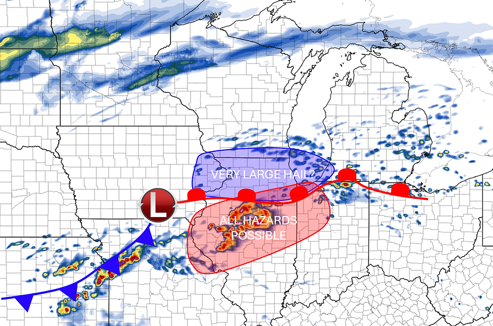
I think the main tornado threat will stay south of the Stateline, though if the warm front pushes north at all, some of our southern counties may need to be on alert, so this is something we will monitor very closely. Large to very large hail looks to be the main threat across the area. Thunderstorms will be elevated and in a cold environment, with steep lapse rates, so any stronger updrafts that form will be supportive of very large hail, potentially up to baseball/tennis ball sized. Again, this is IF storms can fire north of the warm front. We also can't rule out an isolated strong wind gust or two.
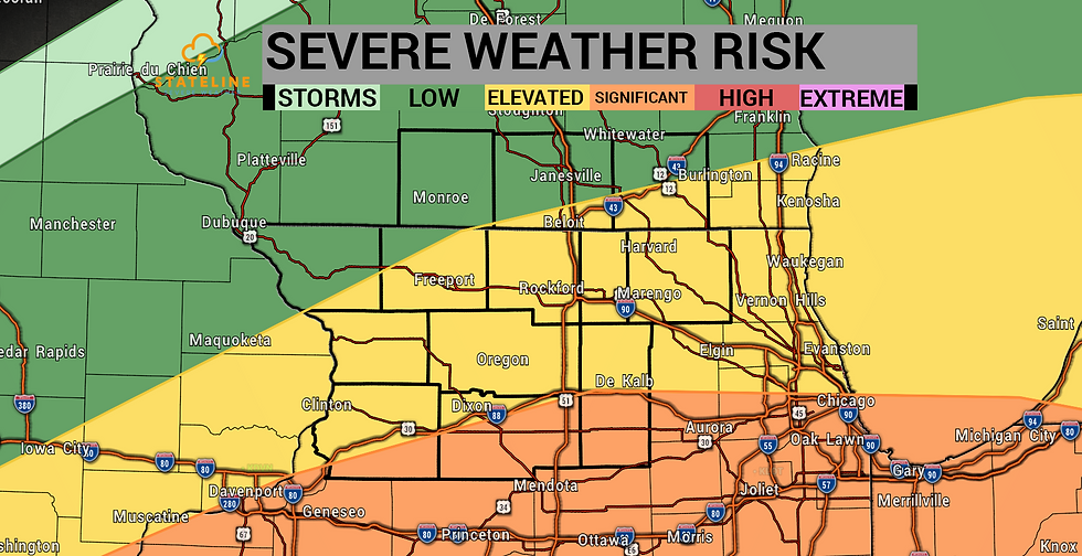
The SPC maintained a level 3 ENHANCED risk along and south of I-88, including portions of Whiteside, Lee, and De Kalb counties, meaning tomorrow will officially be a "Stateline Weather Watch" day. A level 2 SLIGHT risk exists along and east of a Hanover, IL to Orangeville, IL line. Elsewhere, a level 1 MARGINAL risk exists.
The latest HRRR model does try to initiate some thunderstorms north of the warm front, but they don't appear all that impressive given the thermodynamics in place. Perhaps a few of these storms could produce severe hail and maybe a damaging wind gust or two, but that looks to be about it for us at this point.
We will closely monitor the position of that warm front in upcoming model runs and if it shifts north, we will be sure to issue an update on our Facebook page.


Comments