
3/8 | Potential for Significant Severe Weather on 3/10
- Patrick Murray

- Mar 8
- 2 min read
A significant regional outbreak of severe weather looks possible on Tuesday 3/10 as a strong environment takes shape across the area. All severe hazards will be possible, including tornadoes, some of which could be on the strong side.
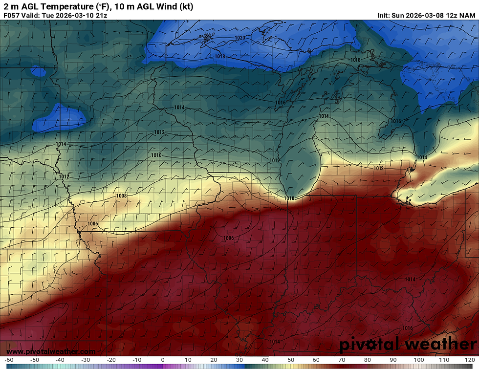
Tuesday will start off as a beautiful day, with sunny skies and temps soaring from the mid 40s overnight into the upper 60s and potentially even the lower to mid 70s in some areas. But this will give way to potentially dangerous weather as the environment primes itself for severe thunderstorms.
There is still quite a bit of variability in models in terms of thermal dynamics, so we will definitely need to keep an eye on warm front placement, though some models easily have the warm front lifting north into southern Wisconsin, meaning all severe hazards will be possible across the Stateline. Again, something we will have to watch and see how it evolves over the next 48-72 hours.
Forecasts from the National Weather Service indicate the warm front stalling near or just north of a Dubuque to Huntley, IL line. Meaning all severe hazards would be possible for our Illinois counties.

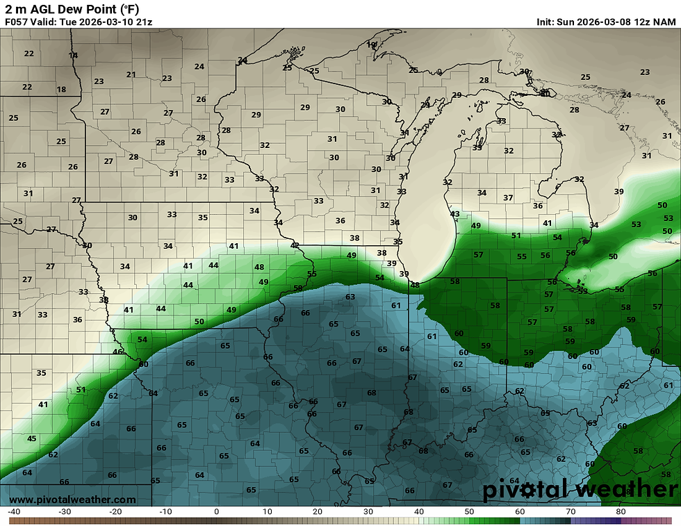
Again, everything is dependent on where the warm front ends up. If the front stalls south of the area, then our main threat would be large hail from elevated supercells in a cold environment. If the front can make it north into the area and stall near the IL/WI boarder, then all severe hazards will be in play.
Currently, most models do have much of the area on the cooler side of things, but it's very possible this changes over the next couple of runs. The NWS seems to think we will be warmer, though they did note in their forecast discussion that they may need to adjust high temps on Tuesday. A very tricky forecast is on tap for Tuesday.
The North American Mesoscale Model (NAM) paints a dangerous picture just south of the area, with significant tornadoes possible given the environment. With surface temps soaring into the mid 70s, and dew points in the 60s, not much will hold storms back from firing and becoming severe south of the warm front.
We're going to continue to closely monitor this evolving forecast over the coming 48 hours. Things will become clearer once finer mesoscale details can be ironed out. Stay tuned for updates.


Comments